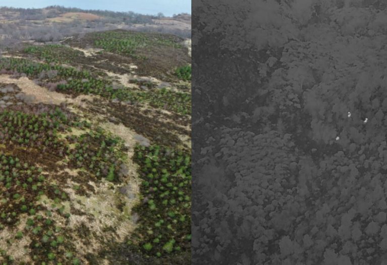
Forestry and Land Scotland (FLS) is trialling the use of drone-captured thermal imaging technology to track deer numbers across 1000 hectares of enclosed conservation woodland around Loch Katrine. After an increase in reports of deer entering the enclosed area, FLS is now able to identify and monitor exact numbers in a bid to prevent damage to the regenerating young woodland. …
